
Paddling the Peel River
Relentlessly Unpeeled in the Canadian wilderness
Overview- Paddling the Peel River
The River Peel catchment in the Yukon, the Canadian North West is one of the last true wildernesses on earth. The Peel watershed is about the size of Scotland with six major tributaries and pristine boreal forestry on and above the Arctic Circle. Our team of six intrepid adventurers came together to undertake this wilderness journey in 2020.
Inspired by a canoe trip undertaken by ‘Protect the Peel’ in 2013 I had planned our trip to traverse six major rivers, covering over 1000 miles by canoe, crossing into the Arctic Circle and crossing the continental divide of the American continent.
The route was to start at Elliot Lake, only accessible by float plane, then follow Elliot Creek into the Hart River which then runs into the Peel River itself. Then continuing down the mighty Peel until it meets the Mackenzie River delta. Before popping out into the Arctic Ocean the plan was to go west and travel 100 miles up the Rat River to cross the continental divide between the North American continent and then descend towards the Pacific via the Little Bell, Bell and Porcupine Rivers in the Yukon catchment. The plan was to finish at the First Nations Gwich’in settlement of Old Crow, the most northerly settlement in the Yukon.
As part of the expedition there would be two major obstacles as well as all the normal hazards of wilderness travel of grizzly bears, lack of access to resupply for food and little chance of immediate rescue in an emergency and huge river catchments with the potential for dramatic rises and falls in rivers levels over short periods of time. The first additional hazard was a portage of Aberdeen Canyon, a 7km portage of canoes and expedition equipment around an ancient gorge which has grade VI rapids. The portage is through a mixture of tussock, swamp and woodland with no pathways. The second major challenge would be the ascent (yes going upstream) of the Rat River. The Rat (named after its historically high population of Muskrats) is notorious as it is around 140km of uphill lining, hauling, carrying of canoes and kit to ascend to ‘Summit Lake’ which marks the continental divide.
Other challenges are the bugs and beasties that live along the catchment. Millions of mosquitoes and black flies are ready to attach themselves to any bit of exposed skin. One piece of good news is that the Yukon doesn’t have any snakes. However it does have high populations of grizzly bears!
As a true wilderness area, one of the last on earth, this area is very remote and a great deal of planning and training was required to pull together a team who could undertake this challenging expedition. The expedition was named ‘Unpeeled’ as we were traversing the Peel watershed and if we were not careful that is what would happen to our team if anything went wrong. Not only is the area one of the world’s last wildernesses, it is home to the First Nations Gwich’in tribal people who hunted and lived off Caribou, and in recent history has been the place the Lost Patrol met its end, was used as a back door route to the Klondike during the gold rush, the Mad Trapper Albert Johnson was finally killed by the Mounties and where the long reaches of the Hudson Bay Company set up trading posts to barter with natives and incoming trappers for a wealth of animal pelts.
Listen to the podcast of the trip with Always Another Adventure.
Trip Planning
The Unpeeled expedition took two years to prepare for; team selection, sourcing canoes in Canada, emergency planning for this huge wilderness area, trying to gain sponsorship, organising a tracking system
for the group, medical support, how to deal with grizzly bears, developing all the canoeing skills needed on the trip. This was completed all through the complexities of the Covid pandemic.
The main team of six people attended four extended training weekends over the two years. The team were selected for their attitude as much as their canoe skills. This was going to be an extended adventure into one of the most wild and remote places remaining on earth.
Each of the four training trips focused on developing fitness for canoeing as well as canoe skills, building teamwork, wild camping and safety protocols for staying safe on wild rivers. The training trips allowed me to whittle down a group of expedition members to three men (Dave, Tom and myself) and three women (Becca, Toni and Claire) to take on the challenge of the Peel watershed.
Each of the training weekends was an adventure in its own right.
For most people each of these trips would be a much sought-after canoeing trip in its own right.
The trips included a traverse of the Great Glen from Fort William to Inverness, a descent of the River Spey, descents of the Findhorn and Nairn Rivers plus a cross Scotland trips which involved lots of lining and hauling as these were skills we would need to ascend the Rat River.
The Highlight of the Great Glen trip for the group was learning to canoe sail, on the Spey developing moving water canoe skills and camp craft.
As part of the trip planning we had also (unsuccessfully) applied for a number of grants and written to firms for sponsorship. Our pleas for sponsorship were more successful than the grant applications and we had
- Palm
- Highland Experiences Ltd
- Tree-disions
- Opticron
- Bending branches
- Pyramid
- Bug Shirt
Towards our final training weekend Claire was unfortunately diagnosed with long Covid and it was decided that she would not be able to take part in the expedition. This left us in a dilemma, we were going to have three canoes on the expedition so nee
ded a sixth person and finding one with only eight weeks to before we left was going to be difficult. In the end we did find someone to takes Claire’s place, Sophie, or paddler X, as she became known as. One of the key resources we used to find Paddler X was Explorers Connect.
Joining a well-developed team at the last minute was going to be a tough ask for our new team member.
Whitehorse
The group arrived in the Whitehorse, capital of Yukon Province in late June 2022. The plan was to spend a few days preparing for the expedition, buying food and supplies, fitting out our canoes, putting the finishing touches to emergency plans and testing our equipment. One of the new pieces of kit we were using on this trip was a Garmin InReach. This would allow us to do a number of things; be tracked by family and friends on a map on our website, allow us to text family and friends if required, get regular weather forecasts and if needed put out an SOS call to the emergency services which in Canada would be the Royal Canadian Mounted Police (RCMP).
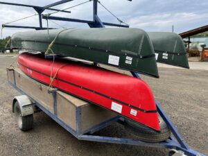
Whilst in Whitehorse some members of the team started buying and sorting the first 3-4 weeks of expedition food and packing it in the barrels we had brought from the UK. The barrels served two purposes, one to keep the food dry in the canoes and secondly to act as bear canisters to try and prevent bears smelling our food and coming into our river camps each night. Toni and I collected our canoes from the Outfitter who had bought them for us. We ended up buying new canoes for this Yukon trip as the local Outfitters didn’t have any second hand canoes to buy after two years of very little work due to Covid. As the canoes were new they needed to be fitted for their spray decks. In the UK it is rare to see spray decks on a canoe, as the rivers are relatively small and most people are doing day trips the canoes are usually open but have air bags for floatation in bow and stern. In Canada the spray deck covers the whole canoe in a waterproof blanket which prevents the boat from filling with water in big waves and rapids, plus keeps out the rain and helps keep paddlers warm in cold environments. It also means the canoe does not need airbags and that saved space can be used for equipment and food storage on longer expeditions. In order to fit the spray deck we needed to drill holes in our brand new canoes. It’s never a nice feeling drilling holes in a new canoe!
In order to get to the starting point of the expedition we needed to access a float plane to fly the group into Elliot Lake (around 600m asl) towards the headwaters of the Hart River. Float planes run mainly from the small town of Mayo which is a six-hour drive north of Whitehorse. Mayo, or Mayo Landing as it was previously known, is today a sleepy town with a population of a few hundred people but back in the days of the fur trapping and the Hudson Bay Company (HBC) and then the Klondike gold rush, Mayo was a transport hub with its own steamboat service. From Whitehorse we hired a transport and trailer to take our canoes and equipment from Whitehorse to the float plane base at Mayo.
Mayo
The float plane base is run by Alkan Air and is based on the banks of the Stewart River. At the float plane base we had our first real taste of one of the thi
ngs we dreaded about the trip – MOSQUITOES. In Scotland we are used to terrible biting beasties – the midge – but these were bad ass mosquitoes. Most people know the female mosquitoes searching for a meal of blood use clues to find us including our body heat, chemicals in our sweat and the carbon dioxide in our breath. What surprised us in Mayo wasn’t that there were mosquitoes, we were expecting that, but that they were in such huge numbers and pretty aggressive. Some members of the team seemed to be more attractive to them, fortunately not me! Asking some of the locals we discovered that this appeared to be an especially bad year for mosquitoes! If there is one reason not to come to this part of the world in the summer it is the mosquitoes. Most of the native wildlife retreats to the tops of the mountains at this time of year to avoid the wet places where the mosquito breeds. We however were about to spend six weeks on the water. Our ‘bug shirts’ and ‘head nets‘ put in an early appearance in Mayo.
One of the other potential hazards on this expedition was bears- grizzly bears in particular. In Yukon you can’t carry a gun in case of bear attack and you are recommended to carry bear spray.
So we had all bought a bear spray in Whitehorse plus a training spray. These bear spray canisters were put onto our belts so we had them with us all day at camp and on the water. Everyone had a practice at using the training canister and we also practiced a ’bear dance’ in case we came across an aggressive grizzly! Essentially if a grizzly was coming into our camp we needed to come together as a group to look big and shout aggressively at the bear to make it go away.
It was surprisingly hot in Mayo and we took the opportunity to have a swim in the Stewart River which was a great way to cool off after the journey from Whitehorse, plus the mosquitoes tended to stay on shore so we escaped them for a while. Towards the end of the day the heat caused a mighty thunder storm with lightning, hail and over 2cm of rain. This proved to be a great reminder for us about siting tents out of hollows and pegging them out properly as a couple of people had flooded tents after the storm.
After a nights camping at the flight plane base we met the pilot for our journey. One thing we had to be really careful about in our trip planning was how much weight we could take on the floatplane. We were limited to just over 1000kg for all six people, the canoes and equipment, plus food. Our planning had meant organizing a strict menu and equipment allocation. The pilot used pallets and a fork lift truck to weight our kit but he was concerned that we had three canoes and his float plane could only carry two (one of each float leg) unless the third canoe was ‘nested’ or fitted neatly over another canoe. This stacking of two canoes proved to be quite an issue and the outfitter we had bought the canoes off had not explained this to us. As we could not stack our third canoe on one of the others as they were all exactly the same size, we had to hire a second float plane to put the extra canoe on. This added around $1000 to our trip. It also meant that weight was now not an issue and the months of careful planning to keep our total weight down was unnecessary as we had two planes to put equipment in.
Elliot Lake to Hart River

We got on board our float plane and took off from Mayo in perfect weather. The twin propeller otter plane gained height quickly over the mountains. There was literally hundreds of miles of nothing except pristine boreal forest and mountain screes. There were no eroded footpaths on the mountains as they are pretty much untouched. This is wilderness on a huge scale.
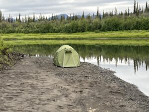
The float planes dropped us at the outfall of Elliot Creek on Elliot Lake. As we were early in the season, the float plane pilot said we were the first group to be on the river in 2022. After looking around we could not find a flat spot to camp and as it was only 2pm we decided to set off down Elliot Creek. Plus we were all keen to get on the water after two years of planning and preparation. Two Trumpeter Swans flew past as we left the lake and in the woodland we saw Waxwings which added to the colour of the day.
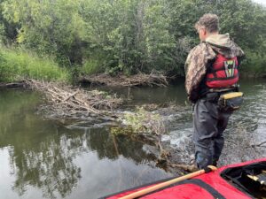
There was a reasonable amount of water on Elliot Creek, we had heard some horror stories about low water levels in the creek requiring paddlers to portage long sections of the river. It is around 25 km from Elliot Lake via Elliot Creek to the main Hart River. We planned to cover this in a day but ended up camping halfway down the creek as we essentially had a half day of paddling as our first day. The creek started as a flat wetland with evidence of beaver dams, but after a couple of hours paddling things began to change.
The creek picked up speed and volume and became a swift challenging route. There were plenty of sweepers and log jams straddling the creek, sometimes the whole creek and they were as big as houses! At one point we had to stop and cut through a few trees to open up the watercourse so the canoes could travel through. There were also a number of tight corners to negotiate and it was here we had some of our first canoeing mishaps.
The river was hard to read with lots of over hanging trees and log jams which would have been caused during the high water levels of the spring snow melt. At one point when heading down a small rapid I was in the stern of the canoe steering and Tom was in the front, I managed to hit a tree overhanging the bank acting as a large strainer. Tom passed through OK but as I ducked to try and avoid the branches the trees bows pulled my paddle from my hands. Although we had an extra paddle on each canoe I did not have a chance to grab this before the next strainer was on top of us, quite literally. The canoe went straight into the tree which was overhanging the river and the trunk pushed the boat over, Tom and I were now swimming. I managed to grab the line at the back of the canoe and scramble up out of the strainer on the river bank, Tom was hanging onto the canoe and trying to get clear of the branches and was in danger of entanglement with both our equipment and the tree. Fortunately he managed to free himself and scramble up onto the river bank. My paddle was recovered by the next group down the rapid but our canoe was now pinned against the strainer with a seriously fast flow of water holding it fast. It took about an hour to figure out how to free the canoe without losing all its contents.
There was lots of concentration needed on this part of the river to avoid the many log jams and strainers; there were a few more spills and swims but none as serious as this first one. By late afternoon on our second day we reached the confluence of Elliot Creek and Hart River.
So far the weather had been exceptionally hot and sunny so we had all had a swim and wash in the creek each evening, only then to dive into our bug shirts to ‘hide‘ from the mosquitoes as we set up camp and cooked dinner.
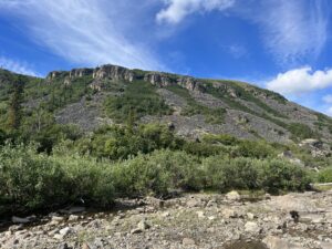
Hart River
Of the six major rivers that flow into The Peel River the Hart is reputed to be the wildest. In 2008 the UN Environment World Conservation Monitoring Centre listed it of global significance in terms of its biodiversity value. The Hart has been a rarely visited and paddled valley as access for canoeists is by floatplane only and then only from Elliot Lake where float lanes can land. It also flows fast through the mountains and in its upper reaches contains lots of log jams.
We spent a week travelling down the Hart River. It was by far the most mountainous section of the trip and the river ran between many ramparts of pinnacles. Each day brought new scenery but all of it was impressive and in many places gendarmes were flanking the mountains. As we progressed down the river it broadened and for the first time we used the spray decks on the canoes which were very useful in the rapids and standing waves preventing the canoes from swamping. Although not classed as technical rapids many stretches of the Hart ran under cliffs round sharp bends and had metre high standing waves, so care was needed whilst running down them.
As we traveled down the Hart we became better at selecting places to stop for lunch and to camp. Anywhere where there was a breeze was good. This kept the mosquitoes away. As soon as the breeze stopped the mosquitoes came in for the kill! For camping there were many gravel bars to camp on. There was a balance when selecting sites –
- not too many willow trees which grew along the banks of the river as the mosquitoes were in the trees, so open gravel banks were best
- gravel being not to large in diameter so you could get a comfortable nights sleep on the gravel
- plenty of firewood on the gravel bar so we had fuel for an open fire
- a good breeze to keep the mosquitoes at bay
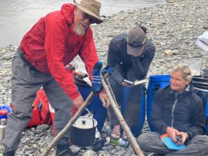
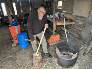
Cooking pot – Peel River
For virtually the whole trip we cooked on open fires, the only time we needed to use our MSR Whisperlite was on the high tundra where there was little firewood and it was so dry there was a high risk of any fire causing embers that could set light to the vegetation. For the stove we did carry some kerosene but this remained largely untouched for the trip. Dave our bush craft expert showed us a range of ways to cook on the fires. By the time we had traveled down the Hart river most of the team were experts at lighting the fires with spruce twigs which were very abundant. One of the new innovative items we brought was an Eco-pot. We could start to cook a meal in a pan and then put it in the eco-pot to continue cooking as we traveled. It worked like a slow cooker. We did have some issues with the pot particularly when we capsized the canoes from time to time.
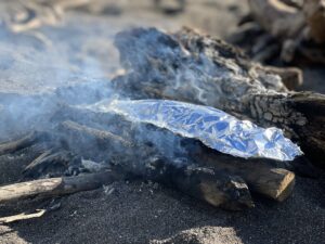
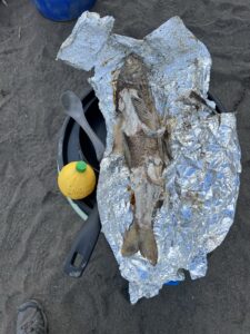
We had hoped to live off the land a little and we had purchased a Yukon Fishing License and bought some fishing tackle for the trip in Whitehorse. In the whole trip we caught three Arctic Grayling so it’s a good job we didn’t rely on catching fish to stay well fed.
For water purification we used Milbank Bags. To be honest for virtually the whole catchment we didn’t need to filter the water as it was so clean, however lower in the river the amount of sediment was large so the water was quite turbid. Milbank bags are based on a design used by the British Army during World War II, and after filtration, it is enough to use chemical tablets or boil water.
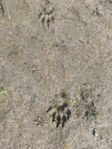
There was plenty of wildlife on the Hart, a few small beaver dams were fairly obvious but every time we stopped there were lots of moose prints on the beaches and many wolf prints too. At one campsite the wolf prints appeared overnight, meaning they had walking through our camp at some point in the night. On the river there were some good views of harlequin duck, American dipper, lesser yellowlegs, spotted and solitary sandpipers.
Every day travelling down the Hart was stunning. The rock scenery was immense as the river cut through the mountains. There were plenty of sharp corners and rapids to keep our attention too. On one day the mountains began to cloud over and get hazy during the mooring. Initially we thought this might be another thunderstorm brewing, but it became clear this was smoke building from a forest fire somewhere. Using the Inreach we texted Mandy our defacto PA to ask if she could find out about any forest fires in the area on the internet. It turned out that by looking on the NASA web page that there was a large forest fire 40km from where we were, probably caused by a lightning strike in one of the thunder storms. The number of forest fires in this area is increasing each year, in number and scale. Another sign of climate change.
Hart River confluence with the Peel to Canyon Creek
The Hart River was an amazing 8 day canoe, it would be great to go back and paddle this section again more slowly and incorporate mountain walks into the trip.
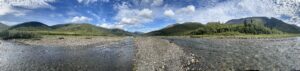
When the Hart joins the main Peel River it not only increases in size but also in character. The landscape continues to flatten out with the main river braiding over a wide flood plain making route choice challenging, and also forming some long cliff lines and gorges.
The northern Yukon has an amazing history with the first discoveries of human habitation about 24,000 years ago in the Bluefish Caves of the Porcupine River. These First Nations people were the Gwich’in who were hunter gathers and survived the ice age in the region as this part of the Arctic Circle was not covered in ice during the most recent ice age. In the winters they hunted Caribou and fished in the summers. The Tetlit Gwich’in on Peel River and the Vantut Gwich’in on the Porcupine River.
The Peel catchment was explored by westerners who were searching for the fabled Northwest Passage. The first to reach the Peel catchment was the ill-fated Arctic explorer Sir John Franklin on his 1827 expedition. He discovered a river ‘new to Europeans’ while exploring the Mackenzie delta. He named the river after Sir Robert Peel the then British Home Secretary who is more famous for establishing the first modern police forces in the UK. In 1839 John Bell started exploring the Peel River for the HBC to find new trading partners and trading routes, particularly a route west to the Pacific.
Today the area is still rich in wildlife; most of our campsites had footprints of moose, wolf and bear. We saw a number of moose and one grizzly bear which was fortunately well fed and not that interested in us plus one wolf. The wolf sighting was particularly close, a youngster running along the base of a series of cliffs no more than 50m from our canoes.
On this section of the Peel River there is a series of Class 3 rapids. These take the form of rock ledges and were fairly easily run or be lined. As the water level was reasonably high we lined all of these rapids. Lining involves getting out of the canoe and using the ropes (painters) at the front and rear of the canoe to ‘line’ or pull and manoeuvre the canoes around large boulders and over drops in the river. This sounds easy but often involves getting into the water to get the ropes around boulders whilst try to keep the canoe upright and their precious cargo dry. Between the rapids the river was paddlable which the hard decision being when to stop and get out of the canoes to recce the next section of river.
The final set of rapids however were hard to spot and were upon us before I realised. They were fairly simple drops so we ran it. Unfortunately although the drop over the first rock ledge went well, there was a second immediately after it. With no time to stop we ran this as well but at its base was a large submerged boulder which quite literally stopped our canoe in its tracks. In fact our canoe stopped but the momentum threw me forwards and my shins hit the thwart infront of me pretty hard. We were now stuck against the boulder and it took a large amount of forward and backwards shuffling and throwing our weight around in the canoe to move us off the boulder. As we did that the canoe swung across the current and Tom and I were tipped into the river. Fortunately it was only a short swim to the shoreline holding onto my paddle and the canoes painter but my shins were already bleeding from the force of their collision against my thwart. It took several minutes for me to regain my breath and realise my shins were not broken just heavily bruised. Looking at the bow of the canoe was a different matter. That now has a large dent in it which broke through the skin of the canoe. It took a good hour of drying and gluing and working with epoxy and denso tape to fashion a temporary repair to the canoe so we could continue on.
We passed an area known as Canyon Creek which we had highlighted as a potential evacuation point on the trip as float planes can potentially land on the river at this point. Once again the local wildlife was doing its best to impress us with a pair of peregrines dive bombing a bald eagle.
From Canyon Creek it is less than a day’s paddle to the first major obstacle of the expedition- Aberdeen Canyon. This has quite a reputation and needs to be portaged. As a group we were cautious that we didn’t end up canoeing into the canyon and as there is a section of Class 3 /4 rapids above the canyon this turned into a nerve wracking day. The rapids were quite apparent and the way the whole river began closing in at the head of the canyon, the only question we had was how far to line down the canyon before cutting off to begin our portage.
The last lining down to the start of Aberdeen Canyon proper was tough and time consuming. The drops we needed to negotiate were progressively getting bigger. We also had to find somewhere to camp next to the river on what was now a rock platform at the river edge. Eventually we stopped at what we thought was a spot a portage could begin and camped.
Aberdeen Canyon
Aberdeen Canyon
Aberdeen Canyon is unrunable with Class 5 / 6 rapids down the Aberdeen Falls. The gorge needs to be by passed by a 6-8km portage. The portage is preceded by a series of challenging rapids, most of which we had already lined. We had read that the portage was on the south side of the river, so half the group went off in search of a good route for a portage, whilst the others started to make camp and repack loads for the equipment carry. After four hours the first group returned and it turned out we had finished our lining of the river around 1km short of the point you can leave the beginning of the gorge to head into the woods to begin the portage. Although this first group had not found a track as such they had spent most of the morning trying to cut a track between trees that the canoes could be dragged through. In the afternoon the second group went down the river to continue to cut a trail for the canoes, however about 10m from the point where the first group had started cutting their route into the forest I noticed a small rock cairn. Upon investigation this cairn marked a small opening through the forest and a vague path. This track had not been used for a couple of years. I guess due to Covid no group had come this way, so it was overgrown and needed quite a lot of cutting back before we could get the canoes along it. Not only this but the mosquitoes were in their thousands in the woodland and bog, and they were vicious. On returning back to the group camp we informed them that their mornings work had been un-necessary as we had now found the pre-existing trail.
Next morning the portage began for real. We still needed to line the canoes another hour downstream to get as close to the portage track as possible and then carry the canoes and all our bags around 1 km to where the portage track began. The plan was then to take our personal kit to the far end of the track so we could set up a new camp at the end of Aberdeen Canyon. The track was boggy, even after the recent dry weather, and there were areas of muskeg and hummocks that were treacherous. It took a good three hours to carry our bags to the far end of the canyon which was along the 5km long track. The last part of the track dropped steeply towards the river and when we reached the bottom we were stunned by the site of an impressive gorge with high sides and a wide gravel bank to camp on. The next day we went back to start transporting the canoes and group kit and food from one end of the gorge to the other.
The canoes were the hardest to move. In the dryer area were black spruce which grew so close together they trapped the canoes at their widest part. The final section of the portage was down the steep bank and required some nifty rope work to lower the canoes. In all it took four days to get all the equipment along the portage track. A huge effort.
We had plenty of rain during these days, the first real rain of the trip.
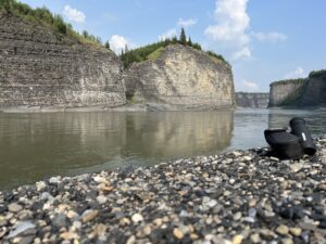
To Peel Canyon and Fort McPherson

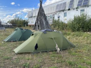
Camping at Peel Canyon – Paddle Peel River
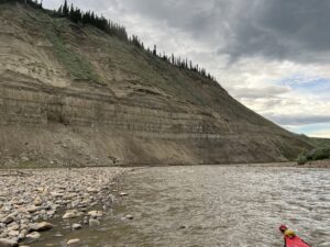
From the end of the gorge we continued down the Peel and as we travelled down the river it was obvious that climate change was already happening in this pristine environment. Before heading out to Yukon and the Arctic Circle I had read of ‘mega slumps’ caused by global warming. The Arctic is warming faster than any other region on earth and the only reason it’s not in the news more is that it is such a poorly populated area. The ‘mega slumps’ are caused by a thawing of the permafrost leading to large areas of landslides. We saw many large landslides as we canoed down the Peel River, and their effects. Once the landslide occurs it releases silt into the river which gets washed up onto the gravel bars and so the willow trees are much more common on the bars and river banks than they were even a decade ago. That meant more mosquitoes at our campsites. The silt also changes the composition of the water making it harder for invertebrates and plants to live in the water which then reduces the fish populations. These effects of global warming in this region are stark and can’t be reversed.
The river continued to broaden and braid until we reached Peel Canyon which is the last place on the Peel where there are graded rapids. At the end of the canyon there is a Class 2 rapid, and just before it was a gravel bar which we camped on. At this point the whole river is forced into a small channel with a shady left hand bend thrown in to boot.
From the gravel bar you could walk nearer to the rapid to take a good look at it. The main feature was some large standing waves leading up to the corner which looked pretty threatening. This gave for fretful nights sleep thinking about taking on the rapids in the morning. However the rapids were soon put to the back of my mind by the vicious nature of the mosquitoes on this gravel bar enclosed by the canyon walls and fresh growth willow trees.
In the morning it was raining hard so we had a slow start to the day, which built up the anticipation of running the rapid.
In the end all three of our teams ran the rapids without a problem although Dave did manage to find the centre of the wave train with 2m high waves and only prevented from being swamped by the canoes spray deck.
Further downstream we passed the confluence of the Peel and Wind rivers. It must have been raining a lot in the Wind catchment as the water entering the Peel was fast, turbulent, full of sediment and contained lots of logs and trees. The other thing we noticed was that many of the cliffs along the river at this point were black. These are points where coal measures come to the surface and there was a strong smell of sulphur along the river here and within the cliffs smoking fumaroles. In the past the Canadian government had talked about mining these areas. Fortunately now this whole area is protected from mineral extraction.
As the journey progressed Tom and I noticed a hissing noise coming from the underside of our canoe and were worried it might mean water was getting into the temporary repair of our canoe. When we came together with the other canoes it was clear that all the canoe hulls were hissing! We came to the conclusion that the noise was caused by all the silt and sediment in the river running across the underside of the canoes. The amount of sediment was also obvious as our nightly campsites began to be on mud banks rather than gravel banks.
From here the Peel River started getting broader as other larger tributaries joined the river. It also slowed down and the waters became murkier as more silt arrived in the waters of the Snake River. The scenery was more lowland woodland with some deciduous black poplar and the sky became wider as the mountains receded.
Many of the rivers which were joining the Peel River were historically used by the First Nations Gwich’in as trails to join hunting areas and from this point on the Peel down to Fort McPherson there were occasional wooden hutted fishing camps by the side of the river, these were old family fishing camps.
As we canoed north across the boundary for the Artic Circle we spotted a Canadian flag flying by the side of the river. We stopped to view the monument to the place the ‘Lost Patrol’ was found.
From 1904 to 1921, it was an annual Royal Northwest Mounted Police tradition to make a trip from Dawson City to Fort McPherson, approximately 620 miles, to deliver mail and dispatches. In December 1910 the trip was to be led by Inspector Francis Joseph Fitzgerald. Accompanying him were Constable Richard O’Hara Taylor, Constable George Francis Kinney and their guide, Special Constable Sam Carter. The four set out from McPherson on December 21, 1910 but they never made it to Dawson. The trip became known as “The Lost Patrol.” Fitzgerald and his men left Fort McPherson, with fifteen dogs, three sleds and enough food for thirty days. They successfully completed the first leg of the journey and hired native Esau George to lead them through the next section. When he had completed his part of the trip, Fitzgerald let George go, trusting in Carter to lead them successfully to their destination. Unfortunately, Carter had been on only one patrol, in the opposite direction, and would soon prove to be an inefficient guide. Starving, frostbitten and ill, the patrol trekked on. Between January 19 and February 5, ten of the dogs were killed for food. In Dawson, the Fitzgerald patrol was more than a month late and a relief patrol was sent to locate the Mounties. On March 21, the lost patrol was found. Kinney and Taylor were dead, side by side at an open camp, Kinney of starvation and Taylor of a fatal, self-inflicted bullet wound in his head. The next day, Fitzgerald and Carter were found. Having left the other two in search of help, they finally succumbed to the cold and hunger, just 40 kilometres away from Fort McPherson. All four men were buried at Fort McPherson.
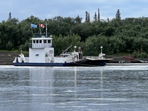
Continuing downstream for another day we finally saw an important landmark – a ferry, the crossing of the Peel of the Dempster Highway. Known locally as “8 mile” as that’s how far it is from Fort McPherson, this has been a traditional crossing place for generations. We stopped and spoke to a few people. The first people we had seen or spoken outside our group for over three weeks. They said it was only 11 km to the town so although it was late we decided to push on.
 Fort McPherson
Fort McPherson was established in 1849 when John Bell, an explorer for the Hudson Bay Company, established a trading post along the lower Peel River. Today the town serves around 900 residents. Fort McPherson is home to the Teetl’it Gwich’in people.
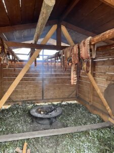
Our arrival at Happy’s Landing (which is the access to the river at Fort McPherson) had been telegraphed as the people who met us at 8 mile had texted ahead to say we were coming. For the past two years the field by the landing ground had hosted a community project which aimed to re engage Gwich’in with traditional ways of life like catching and smoking fish. This community camp helped us greatly and Diane who ran it was amazing and supportive of our group as were her staff.
It didn’t take long for the whole town to know we were about. With two years of Covid restrictions there had not been many canoes pass the town, so we were quite a novelty. Prices for buying food were extremely expensive but that’s not surprising as it all has to be flown in or driven from Dawson City along the Demeter Highway.
There had been a death in the village and on a number of occasions different community members invited us to visit the home of the family to eat with them. This is a Gwich’in custom and one evening we did go round to their home to meet and feast with them.
Diane also made sure we were well fed and watered, an old Gwich’in tradition! Over the course of the two days we were there we were offered local dried fish, fish stew, caribou stew which was wonderful and tasted like beef. Plus fish jerky to take on our travels. There was always a cup of tea or coffee on hand plus some Labrador tea which is made locally from an aromatic plant that grows up in the highlands. It is reputed to have healing properties especially for stomach problems.
Diane also told us her mothers’ story. She was one of the last of the Gwich’in to be enrolled in the Indian residential school system, a network of boarding schools for Indigenous peoples. The school system was created to isolate Indigenous children from the influence of their own native culture and religion in order to assimilate them into the dominant Canadian culture. Over the course of hundred-year, around 150,000 children were placed in residential schools with the number of school-related deaths estimated in the range from 3,200 to over 30,000. The schools were intentionally located at substantial distances from Indigenous communities to minimize contact between families and their children. They harmed Indigenous children significantly by removing them from their families, depriving them of their ancestral languages, and exposing many of them to physical and sexual abuse. Students were also “assimilated” as citizens that removed their legal identity as Indians. Disconnected from their families and culture and forced to speak English or French, students who attended the residential school system often graduated being unable to fit into their communities but remaining subject to racist attitudes in mainstream Canadian society. The legacy of the system has been linked to an increased prevalence of post-traumatic stress, alcoholism, substance abuse, suicide, and intergenerational trauma which persist within Indigenous communities today. Religious communities have issued apologies for their roles in the residential school system. In 2015, the Truth and Reconciliation Commission concluded that the school system amounted to cultural genocide. Ongoing efforts since 2021 have identified thousands of probable unmarked graves on the grounds of former residential schools, though no human remains have yet to be exhumed. During a penitential pilgrimage to Canada in July 2022, Pope Francis reiterated the apologies of the Catholic Church for its role in administering many of the residential schools. This is an important issue in the area as Fort McPherson’s residential school was the last to be shut down in the whole of Canada.
Fort McPherson was the mid point of our journey. One major obstacle completed, Aberdeen Canyon, and another to come, ascending the Rat River. So far on the expedition we had been a group of six. After much discussion it was decided that the group should split and Dave and I continued on the expedition as a pair in one canoe.
Heading for the Rat River
After leaving Fort McPherson the next major obstacle for the new pairing of the over 50’’s (Dave and myself) was the ascent of the Rat River and the crossing of the North American continental divide. As we were only a few miles from the Mackenzie delta with all the historical connotations that implies we were keen to visit it. As we paddled down from Fort McPherson we passed the junction of the Husky Channel which leads to the Rat and went on for another 10km to the Mackenzie. The Peel River where it runs into the Mackenzie is slow and broad and almost estuarine with deep muddy banks and lots of silt in the water. This area is a wildfowl hotspot during migrations and we spotted a small group of lesser sandhill cranes. After visiting the delta we needed to head back upstream to the Husky junction. Canoeing downstream it hadn’t felt like there was any current but when we turned around we realised that wasn’t the case. The flow was enough to make paddling hard work so when we could we lined the river along its deep mud banks. It took nearly a day to return back up to the Husky Channel, 10km that took up only a couple of hours going downstream.
The Husky Channel was a slow moving estuarine river too and after about 25 km we reached the junction with the Rat River marked by a fishing camp. From this point it was all upstream for the next two weeks or about 130km.

 The Rat which travels through the Richardson Mountains is an ancient Gwich’in trail crossing the continental divide. The Gwich’in name for the river translates to ‘the river inside the mountain’. These First Nations people never told the HBC about this route even though they looked for an efficient way to link their west-east fur trading route for centuries. However in 1872 James McDougall ‘discovered’ this river route which would have shortened the HBC trade routes. By this time the route was not pursued as fur trading was beginning to wain. The route was used during the gold rush. The description by Robert Service of his journey up the Rat in 1911 will give you an idea of what we had let ourselves in for, “in all my life I had never worked so hard as I did in the next few weeks. As I tugged, strained, plunged knee-deep in water, panted and lunged while muttering ‘what a bloody fool you are! ‘ “.
Initially the Rat River was a meandering slow silty river about 10m wide. Paddling upstream although hard was manageable at about 1.5 km an hour. The banks here are about 10m high, covered in thick willow and these hold back thousands of lagoons which are the home to thousands of beavers. There were very few places to pull off the water and rest and even fewer spots to camp. Not only that the windless channel was home for thousands and thousands of vicious mosquitoes. So bad were the beasties that even 30% DEET was now ineffective against them. They bit though our previously impervious bug suits where the straps of my buoyancy aid went around my waist. One thing we have not discussed yet in this blog is going to the toilet. There was one big danger with going for a poo and that was getting mosquito bites on your bum. In 1926 two British women were guided up the seat by a local guide Lazarus Sittichinli. One of the women Clara Rogers wrote about the experience. I’ll give a couple of quotes from her to give some context to the Rat and its mosquitoes, ’the Rat was no pleasure trip, it was swift, rough, cold, and mosquito haunted. Every old timer we talked said it was scarcely navigable’, ‘fighting through willow and alder scrub, pushing and pulling the canoe through the water, over boulders and rocks, whilst waist deep in the icy current. We could never stop and rest as the mosquitoes drove us on. The Rat was days of constant struggle, continually soaked with anxiety about rising water levels’ and finally ‘even our party, most of us with several seasons’ experience of northern bugs, and with good protective gear, the mosquitoes of the Rat were a sore trial. I remember a sense of complete outrage the way those clouds of insects zoomed in on the exposed parts of my anatomy when necessity forced me to lower my pants’.
Whilst we were paddling in this initial part of the river, If it had rained hard upstream we would be simply washed back out of this high sided channel back to the Peel River.
We had to camp in this channel which was unpleasant. We did find one sandbar that was about 1 m above the river level and it was the only suitable site we found after hours of paddling, so although it was not perfect by any means we stopped there. Within minutes of us setting up camp a beaver swam around the corner to take a look at us and displayed his displeasure at us imposing on his territory by tail slapping loudly. This continued for most of the night making it difficult to sleep. It didn’t rain overnight although the river did rise about 20cm. So we headed off early to complete this first stretch of the Rat River, which runs for around 35 km from the Husky confluence to an area known as Destruction Camp, or more historically Canoe Landing. At Canoe Landing the Gwich’in would leave their birch bark canoes and continue up the Rat on foot. However after a gold rush party overwintered at this spot it became called Destruction City as they dismantled their boats and gear to carry them over the mountains.
When we arrived at this spot the river changed character quickly with the gradient steepening so the river flowed faster and the silt disappeared and a rocky boulder strewn river appeared.

 From here we stopped canoeing and started lining up the river. This is the area where one of the area’s most famous (infamous) characters lived. Albert Johnson the ‘Mad Trapper of the Rat’. On 31 December 1931, an RCMP constable investigating a complaint about trap lines was shot and seriously wounded by a trapper living west of Fort McPherson. The ensuing manhunt — one of the largest in Canadian history — lasted 48 days and covered 240 km in temperatures averaging -40°C. Before it was over, a second policeman was badly wounded and another killed. The Trapper’s extraordinary flight from the police across sub-Arctic terrain in the dead of winter captured the attention of the nation and earned him the title “The Mad Trapper of Rat River.”
From this point on we were lining and hauling the all the way. Dragging the canoes up rapids whilst wading in murky waters where you couldn’t see the bottom of the river, stumbling and falling over getting soaked. The Rat also has a reputation for fast rising waters. So after every shower or thunderstorm we watched the water level carefully- at each place we camped we built a mini cairn by the side of the water to help monitor if it was rising or falling.

Richardson Mountains – Rat River
Although hard work, the Rat was actually a very pretty and aesthetic river. Its source is in the Richardson mountains hence the views heading west up the river were great. The first few days of the haul were over a fast flowing braided river, not unlike the Spey. The key techniques used fell into three categories-
- Lined from the bank or by wading through murky water trip over boulders
- Wading along edge of deep river banks to get by tree stumps, log jams or strainers. By now the crotch zip on my salopettes had broken so every time I waded I was soaked inside my breaches. This eventually led to rubbing between my boot and socks resulting in painful friction burns on my toes
- Ferry gliding across faster or deeper sections of river.
The next section of the ascent is referred to as the canyon area which takes a couple of days to get up. As the name implies the whole of the river is pushed into the narrow high sided gorge making progress slow. Most days we were making less than 1 mile per hour! Just to compound things for the next two days there were gale force headwinds down the valley.
Crossing beaver dams Rat River
Once out of the canyon you reach the Highlands. The mountains start looking close and progress really starts being made. The river becomes one channel and although still lining the canoes the river is less steep so progress feels more positive. Another day on and we were hauling the canoe between the mountains. The scenery was stunning with willow ptarmigan calling from the moorland.
After 10 days hard work ascending the Rat we were feeling like reaching Summit Lake on the continental divide was achievable in another day or maybe two! How little we knew.
I haven’t mentioned navigation much so far in this trip report but to be honest going downstream navigation is pretty simple. Heading up a river like the Rat, the size of the Spey, you would have thought navigation would be simple too? How wrong we were. On the expedition we had a Garmin InReach with very basic maps but I didn’t want to rely on a GPS and use good ole fashion expedition craft to find our route. I have always tried to run my expeditions as low tec as possible. When I crossed the Patagonian ice cap we used an A4 print out from google maps for the 4 week journey.
Generally on the Rat there were numerous burns entering the river system but they were often disguised as braiding due to the wide river flood plain. All the way up the river we had simply taken the larger river branch when we hit a confluence.
From where we were anticipated we should only be about a days hauling from the col (McDougall Pass) between the Peel and Yukon River catchments. We continued upstream through a section where once again the river gradient steepened and we struggled to drag the canoe up through a large boulder garden below what looked like an ancient terminal moraine. After a few hours we were above the moraine in a flat bottomed valley which still contained a couple of feet of snow pack. Alarm bells began ringing as we continued upstream and the angle of the river wasn’t relenting. By that evening when we had anticipated being near the col we were in a river valley between some of the highest summits of the Richardson Mountains. We now knew we had taken a wrong turn somewhere!
The next day it took half a day to return about six kilometres downstream to find the correct river junction to follow to complete the Rat ascent! The junction we had missed is quite infamous it turns out, and in fact one of the elders in Fort McPherson had actually warned us about it in a round about way. He had told us that we were ‘crazy’ to be going up the Rat and ‘you know you are in the right place when you reach the waterfall which is about 1m high’. This is backed up by an old report on paddling in the Yukon which say about the Rat ‘keep your eye on the map as you approach the top of the watershed, at “Rat Forks” creeks flow in from the north, south and west. Make sure you head west. You know you are in the right channel if you encounter a small narrow waterfall a few metres up the channel’.

The creek we had missed was about 10 m wide and hidden in woodland where as the main river we had followed was about 30m wide!
Once we had hauled our canoe up the waterfall we felt the upstream journey was at an end but the river had other ideas. The river slowed down and became an enclosed meandering mosquito infested high banked trial similar to the initial lower reaches of the Rat! As the crow flies it was only 3 km to the first of a series of lakes across the pass but it was over 10km of meandering slow hauling and some paddling to reach the lakes though interminable unending meanders. To add to our pain beavers had been hard at work putting dams across the river which all required us to haul the laden canoe over. It took nearly 8 hours to complete this section of the river and arrive at the first lake crossing the continental divide.
The vegetation here was much more tundra like with bare berry, blueberry, crowberry and cowberry all in full yummy fruiting season. We also collected some of the aromatic Labrador plant which had been recommended for tea making.
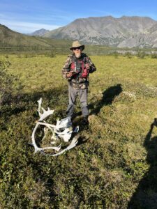
Caribou Antlers at Ammo Box Summit Lake
It took another day and a half of portaging between the series of lakes across the pass to finally reach Summit Lake.
Across all these lakes beavers had been hard at work building lodges and dams. They usually greeted us with their tail slapping.
At Summit Lake we looked for and discovered an old ammunition box (marked by a pile of old Caribou antlers) with the ‘Summit Lake Guest Book’. This is an informal log of people arriving at
Summit Lake since the 1960’s. It turned out we were the first group to sign the register since 2015!
Little Bell to Old Crow and the end of the journey
The next part of our journey was to paddle down the Little Bell River, down the Bell itself and on to the Porcupine River in the Yukon catchment. We were estimating it would take another 10-14 days to reach the isolated Gwich’in settlement of Old Crow.
We had hoped the descent would be a simpler affair than the ascent but not to be. The initial section of the Little Bell River is minuscule. A couple of metres wide like a drainage channel and clogged with dozens of new and old beaver dams. It took a couple
Of hours of vigorous pulling, twisting, lifting and generally grunting to pull the canoe and its cargo down this ditch called the Little Bell. After the first few hours however the channel began opening up so it was at least possible to paddle, if still meandering! It took the whole day to reach the Bell River which heads west towards the Pacific.
As the Bell widened over the next couple of days the weather started to deteriorate with rain and wind most days. We passed the remains of Lapierre House, an abandoned HBC trading house and finally reached the slow flowing Porcupine River which broadened to become 100-200m wide. From here we estimated it would take another 5-6 days to reach Old Crow. The next three days however were dominated by headwinds, force 4-5 winds which made progress at best slow, down to 1-2km per hour and at worst impossible to where we needed to get off the river and out of the waves.
About 60 km away from Old Crow we met our first humans for three weeks, Robert and Clifford heading up river hunting on their flat bottomed boat. They stopped for a brief chat and headed upstream in search of Caribou or Moose. Robert and Clifford are both Vantut Gwich’in and for thousands of years their ancestors have hunted caribou in this area. In 2011 Robert worked with Bruce Parry on his series Artic which highlighted the Vantut hunting lifestyle. Robert it turned out was also a cousin of Diane who we had met in Fort McPherson.
At this point in the trip it was great to chat to other humans, no matter how briefly! The headwinds had not stopped so when Robert and Clifford passed us heading downstream late in the day we asked if they could give us ride to Old Crow. Fortunately for us they agreed and we had an amazing 1 hour boat ride to the end of our journey.
The residents of Old Crow were exceptional, accommodating and allowed us to camp near the museum for a few days whilst we waited for a flight back to Whitehorse. During this time we were lucky to meet some of the elders and chiefs for the Vantut, share food and stories with them. Dave spent his last couple of days in Old Crow making an indigenous arrow from black spruce and caribou horn as a gift for the museum.
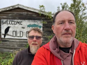 Old Crow and the area around it are remarkable. The town of around 300 people is also the northernmost community situated in Yukon without road access. The people of Old Crow are dependent on the Porcupine caribou herd for food and clothing, once again this is proving challenging for them as their migration routes are changing due to climate change and oil drilling in Alaska. Old Crow is also a dry community so maybe not the best place to have chosen to end our journey!
 The area around Old Crow is a National Park, the Vantut National Park. The name Vantut comes from the Gwichʼin for ‘among the lakes’ and the Park has less than 25 people visit each year. This area, north of the Arctic Circle, was free from permanent ice during the last ice age making it unique. It also holds evidence of human habitation from over 20,000 years ago.
So here we were after nearly 1500km (1000miles) of canoeing in the Peel and Yukon river catchments after an immense and beautiful journey. Undoubtedly the journey of a lifetime through the Canadian wilderness. We had seen wolves and grizzly bears, travelled through places very few other humans had been and met some remarkable and hospitable Gwich’in people along the way.
Useful reading
J Peepre & S Locke,2020, wild rivers of the Yukon’s watershed, second edition.
If this all sounds exciting to you, join us for a trip to the Canadian Wilderness in 2023! Read more here.
Comments are closed